Death Valley is a very surreal national park, filled with amazing slot canyons, sand dunes, salt plains and colorful mountains. Located in California and Nevada, it is one of the largest national parks in the western hemisphere. I knew I had to check this place out when I researched it a while ago, being an easy adventure on my bucketlist! After mapping out the route, my fiancé and I decided to take a drive to the lowest point in America, Badwater Basin.
What is Badwater Basin? It is a HUGE area of salt flats located at 282 ft below sea level. The area is about 5 miles wide and 8 miles long. It is composed of salt that came from rain and minerals dissolving from rocks over time. When heavy storms occur, the water forms temporary lakes which then evaporate! This creates beautiful geometric shapes on the salt floor, so white that you think you are walking on another planet!
Fun Fact: Badwater Basin got its name from a surveyor that was passing through with his mule. Because the water is so full of salt, the animal refused to drink it and the surveyor claimed it as “bad water”. Yep, there is water here in the middle of the desert! The Badwater Pool (which you can see from the boardwalk) is not poisonous, just very salty. A few tiny creatures live in this water such as pickleweed, aquatic insects, larvae, and snail. Knowing that, we did not bother going near the pool of water. Eek!
When to Visit: Anytime between late October and early March. The park heats up quickly during the summer/early fall months, so there are fewer crowds and more risk of dehydration while hiking (there is ZERO shade cover). Highly recommend going during the winter months when the weather is 50-60 degrees during the day.
Park Entrance: The entrance to the park was not like the other national parks; we had to pull off and pay at a self-service machine. The machines only take credit card, and there are 12 locations where you can go to pay. Also, I did not see any shuttle services while we were there, so check when planning out this trip, especially if you use shuttles around other parks.
Round Trip Length: 1 mile (to edge of salt)
Round Trip Time: About 40 minutes
Difficulty: Easy
Elevation Gain: Flat
Trail: Boardwalk then onto the salt flats, out and back
Location: Badwater Road, 30 minutes south from Furnace Creek
Parking: Decent sized (free) parking lot
Restrooms: There are vault toilets nearby
What to Bring:
-Water: does not matter when you go, always have a filled camelbak or a couple water bottles handy.
-Head Protection: there is zero shade, so I highly recommend bringing a hat or umbrella. I decided to try something different this time and went with a fedora hat!
-Sunscreen: it does not hurt to always have this handy just in case.
–Gimbal Stabilizer: this works like a charm when you are creating videos with your phone!
-Tripod: you can take amazing photos by yourself here, especially since the elevation is flat you do not have to worry about it falling over.
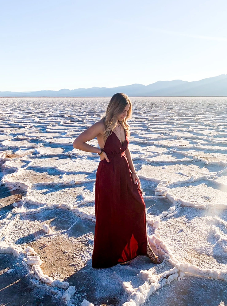
-Loose Flowy Clothing: you can dress however you want on this hike, just make sure you have comfortable shoes. Since this hike was only 1 mile, I decided to dress up for these photos. The dress I wore was long and wine color so I can really stand out.
We had to walk pretty far where it showed the crisp, white shapes on the salt floor. The mountains looked like an incredible backdrop beyond the landscape. We got there around late afternoon, so we did not have much time before the sun went down. It was a clear sunny day so the pictures we took captured more than enough of its beauty. Overall, if you are looking for an otherworldly experience, I highly recommend checking out this spot!